U.S. Weather Emergency: Complete Guide to Northern Blizzards and Southern Flooding Crisis
Anúncios
Overview of the Weather Emergency
As multiple severe weather systems wreak havoc across various regions of the United States, millions of residents are on high alert.
The nation is grappling with both extreme flooding and harsh winter conditions.
Anúncios
Flood Alerts
Approximately 20 million people face flood alerts stretching from Arkansas to Pennsylvania.
The Southeast, notably Kentucky and Tennessee, is particularly vulnerable to life-threatening flash floods, with rainfall anticipated to reach up to 8 inches.
Anúncios
This intense precipitation is causing severe disruptions, including widespread road closures and emergency responses in the affected areas.
Power outages are also rampant, further complicating the situation for those in the flood zones.
Winter Weather Alerts
Simultaneously, around 70 million people are under winter weather alerts from Nebraska to Maine.
Northern regions of the country, including Michigan, upstate New York, and New England, are bracing for heavy snowfall.
Projections suggest snow accumulations could reach 12-18 inches in New England alone, making travel extremely hazardous as a wintry mix of snow and ice coats the roads.
The sheer scale and simultaneous occurrence of these events underscore the urgent need for communities to stay updated on weather alerts and take appropriate safety measures.
With these severe conditions sweeping across the nation, being prepared and vigilant remains critical.

Southern States Flooding Crisis
Catastrophic Flash Flooding
The Southern United States is currently grappling with severe flooding, with Kentucky and Tennessee facing life-threatening conditions.
Torrential rainfall, reaching up to 8 inches in certain areas, has caused rivers to swell and overflow their banks.
These floods have left a trail of destruction in their wake, including widespread road closures and stalled traffic, disrupting the daily lives of thousands.
Emergency Responders on High Alert
Emergency response teams are working around the clock to assist those in need.
Swift water rescue teams have been deployed to the hardest-hit areas, and local authorities have set up shelters for displaced residents.
Preparations were made in advance with the deployment of over 1,000 sandbags and barricades in flood-prone regions, particularly in Clarksville, Tennessee.
Power Outages and Infrastructure Strain
As the relentless rain continues, power outages are compounding the crisis.
Thousands of Tennesseans and Kentuckians are currently without electricity, and more blackouts are expected as additional rainfall exacerbates ice accumulation on power lines and trees.
The already strained infrastructure is under immense pressure as authorities work to restore power and ensure the safety of citizens.
As we navigate these challenges, communities are coming together to weather the storm.
The ongoing severe weather further necessitates caution and preparedness across the Midwest and beyond.
Severe Weather and Storm Systems
Thunderstorm and Tornado Risks
A volatile weather system is threatening the lower Mississippi Valley with severe thunderstorms and tornadoes.
This region includes parts of Arkansas, Louisiana, Mississippi, Tennessee, and Texas, where tornado watches are already in place.
Residents in these areas should stay alert as the threat of strong tornadoes looms large, with these potentially destructive storm cells bringing intense wind gusts reaching up to 70 mph.
Additionally, hail might accompany these fierce storms, increasing the danger to people and property alike.
Destructive Wind Gusts
More than just a tornado threat, the storm system is characterized by powerful winds that can cause significant damage.
These winds can reach up to 70 mph, causing widespread issues such as downed trees and power lines, along with dangerous debris being projected.
Power outages have already been reported, with Louisiana seeing more than 8,000 customers without power.
The importance of preparedness in these areas cannot be overstated, especially given the potential for continued disruptive winds.
Extensive Rain and Thunderstorms
The weather system doesn’t only threaten with tornadoes and gusts; a broad area of rain and thunderstorms is impacting the mid-Atlantic and Southeast regions.
Up to 8 inches of rainfall are anticipated in some places, raising the risk of persistent thunderstorms throughout the weekend.
This intense rainfall has already led to flash floods in parts of Virginia, Tennessee, and Kentucky, causing severe disruptions including road closures.
It’s crucial for communities in these affected regions to stay updated and heed local warnings.
Transition
While the Southern states brace themselves for severe weather, the Northern regions aren’t spared as they face significant winter challenges…
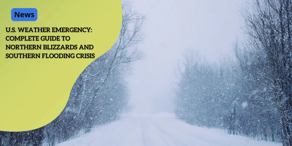
Northern Blizzard Conditions
As severe weather wreaks havoc across the United States, the Northern regions brace for significant blizzard conditions.
Heavy snowfall is expected in Michigan, upstate New York, and the New England area, pushing emergency services to prepare for the worst.
Anticipated Snowfall
The heaviest snowfall is predicted to accumulate in New England, with potential totals ranging between 12 to 18 inches through Sunday.
This profound accumulation of snow targets cities and rural areas alike, posing challenges for daily life and travel.
Driving Hazards
As the snow piles up, a wintry mix of sleet and freezing rain will make driving conditions hazardous across the Northeast.
The combination of sleet, snow, and freezing rain will likely create slick and dangerous roads.
It’s crucial for drivers to exercise extreme caution, as power outages due to icing are likely.
Power Outages and Travel Warnings
Strong winds accompanying the snowfall in these areas can further exacerbate conditions by leading to power outages and property damage.
Residents should be prepared for disruptions, especially in regions with heavy snowfall and significant ice accumulation.
Without a doubt, the severe weather in the North demands vigilance and preparedness.
Having robust emergency plans and adhering to travel alerts will be essential as this storm system continues to challenge affected residents.
Impact and Safety Measures
Emergency Preparations
As the severe weather systems continue to affect various regions, emergency preparations have become paramount.
In flood-prone areas, such as parts of Kentucky and Tennessee, local officials have deployed thousands of sandbags and barricades to manage the life-threatening flash floods.
These measures aim to protect properties and divert the rising waters away from critical infrastructure.
Power Outage Risks
The severe weather poses significant risks of power outages across multiple states.
In both the southern and northern regions, ice accumulation and strong winds are expected to down power lines and disrupt electrical services.
Residents are advised to be prepared for prolonged periods without power by having emergency supplies such as flashlights, batteries, and non-perishable food items readily available.
Travel Advisories
Travel has become increasingly hazardous due to the severe weather.
The heavy snowfall and wintry mix in the North, along with flash floods in the South, have led to numerous road closures and treacherous driving conditions.
Authorities have issued travel advisories, urging residents to avoid unnecessary travel and stay informed through local news channels for updates on road conditions and safety warnings.
The storm’s progression will remain a concern as it continues to impact significant portions of the country.
Residents must remain vigilant and prepared as the situation evolves.
Future Weather Outlook
 Event Event |
Details |
|---|---|
 Storm Departure Storm Departure |
The storm system is expected to leave the East Coast by early next week. |
 Cold Air Presence Cold Air Presence |
Frigid conditions will persist across the eastern U.S. due to lingering cold air. |
 Wind Alerts Wind Alerts |
Approximately 76 million residents are under wind alerts, with gusts expected between 40–60 mph. |
 Affected Areas Affected Areas |
Major cities affected include Jacksonville, Asheville, New York City, Boston, and Washington, D.C. |
 Power Outages Power Outages |
Strong winds could lead to additional power outages and hazardous conditions. |
 Safety Advisory Safety Advisory |
Residents from the Midwest to the Southeast should remain vigilant and prepared. |